 Wehealth
PHapp is now available, as an app and website!
We are excited to announce that PHapp is now available, both as a downloadable app and a website. PHapp adds local resources, maps and personalized...
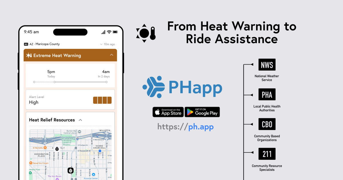
When an extreme heat warning hits your phone, what happens next? For most people, it's just another notification to dismiss. But what if that alert could instantly connect you to nearby cooling centers, hydration stations, and even free transportation to safety?
That's exactly what PHapp does – transforming basic weather alerts into comprehensive, life-saving resources with just one tap.
The National Weather Service (NWS) provides the critical foundation for public safety with their precise, timely extreme heat warnings. These scientifically-backed alerts are essential for protecting communities nationwide. Through our official partnership with NWS, PHapp is able to build on this trusted foundation by adding the next layer of emergency response: connecting people to local resources and action.
While NWS excels at telling communities when dangerous heat will occur, our partnership allows us to answer the natural follow-up question: "Where can I go for help, and how do I get there?"
Working directly with the National Weather Service, PHapp enriches their authoritative weather warnings with hyperlocal data from trusted community sources:
National Weather Service (NWS): Provides the initial extreme heat warning with timing and severity
Local Public Authorities and Government Agencies: Contribute official cooling center locations and health guidance
Community Based Organizations (CBO): Share grassroots resources like pop-up cooling sites and hydration stations
Community Resource Specialists (211): Offer comprehensive social services and emergency assistance information, including calling a free ride for people that need help with transportation.

Thanks to our partnership with NWS, when they issue an extreme heat warning for your area, PHapp receives this authoritative data and immediately connects it with local relief resources. You get the same trusted NWS timing and severity information, enhanced with actionable local resources and visual enhancements.
Instantly see a map of nearby cooling centers, hydration stations, and emergency shelters. Each location is verified by local authorities and community partners, so you know the information is current and reliable.
Found a cooling center that's open? PHapp makes it easy to take action:
Take the example shown in Phoenix: when an extreme heat warning is issued for Maricopa County by the Phoenix NWS Office, PHapp users can immediately see resources provided by the Maricopa Association of Governments' (MAG) Heat Relief Network which includes Hydration Stations, Cooling Centers and Respite Centers. With one tap, they can request a ride or get directions through 211 Arizona – turning a potentially dangerous situation into a manageable one.
What makes PHapp unique is our official partnership with the National Weather Service, combined with deep local community connections including Arizona Department of Health Services (ADHS), and active collaborations with public universities including the University of Arizona College of Public Health. By building on NWS's authoritative weather science and connecting it with local knowledge from public health authorities, community organizations, and social services, we create a comprehensive safety net that leverages the best of both federal expertise and grassroots community knowledge.
Local organizations know their communities best. They know which locations are accessible, which services are available, and how to reach people who need help most. PHapp amplifies this local expertise by making it instantly accessible during emergencies.
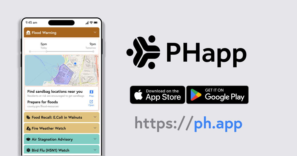
While this example is for extreme heat, the PHapp model works for any emergency where local resources matter. Whether it's severe weather, air quality alerts, or public health emergencies, the same principle applies: transform generic warnings into actionable, location-specific resources.
PHapp is available nationwide in the US, on iOS and Android devices as well as on the web at ph.app. Download it and start receiving enhanced emergency alerts for your area.
Because when emergencies strike, you shouldn't have to figure out what to do next. You should already know where to go – and how to get there safely.
We are excited to announce that PHapp is now available, both as a downloadable app and a website. PHapp adds local resources, maps and personalized...
1 min read
Wehealth Notify is a free app for the public. Built with CDC funding and in partnership with National Oceanic and Atmospheric Administration (NOAA) /...
PHapp was released to the public on Apr 2, 2025 as a downloadable app and a web app. It was announced at the Preparedness Summit in San Antonio on...